Profile Equipment
High-tech
AERIX · by Ecotax

Know what is flying above you. And what to do about it.

Distributed drone detection. Remote ID, RF and third-party sensors in one operational picture.

A drone over a port, a prison or a stadium is rarely the problem. Not knowing about it is. Who is flying, from where, how long has it been there, and what could it see?

AERIX answers those questions with a network of small detection nodes instead of one large installation. It starts with a phone, grows with fixed and RF sensors, and brings everything together in a single live picture of the airspace, from the first detection to the report that goes with it.

Visit aerix.ecotax.cloud
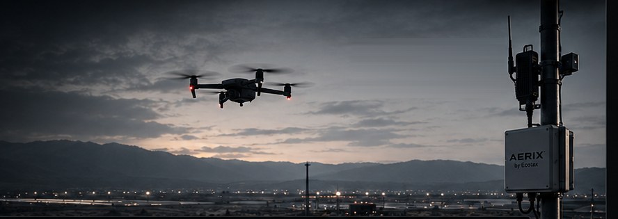
A drone at dusk passing an AERIX detection node mounted on a mast
1
operational picture, for every sensor and every site
4
hardware types, from a phone to wide-area RF
3
steps: detect, understand, respond
Minutes
to start a network with phones as sensors
NL
developed in the Netherlands, by Ecotax
The idea

Many small sensors see more than one big one.

Classic drone detection puts one expensive system on one roof. It sees its own surroundings and nothing else. AERIX turns that around: a network of independent, affordable nodes, each covering its own area, all reporting into the same platform.

That makes coverage a matter of adding nodes. One site today, a city next year, a national network after that, without replacing what is already in place. And because every node reports to the same picture, a drone that leaves one site is still on the map when it reaches the next.

  • A network of independent detection nodes instead of one installation.
  • Scales from a single site to national-scale networks.
  • Start with mobile apps, add fixed nodes, RF sensors and integrations as needed.
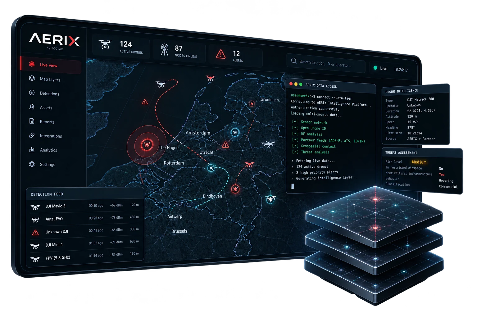
The AERIX platform on a tablet showing active drones, online nodes and alerts on a map
From sensors to action

Five steps from a signal in the air to a decision on the ground.

AERIX fuses data from multiple sources into one real-time, unified airspace picture.

  1. 1

    Sensors

    Remote ID, RF, radar, cameras and third-party feeds each see a part of what is happening.

  2. 2

    Ingest

    Every node delivers its data securely to the platform, however many nodes there are.

  3. 3

    Correlation

    AI-assisted fusion combines what several sensors saw into a single track per aircraft.

  4. 4

    Tracks

    Each drone is followed continuously, with the airspace it is in as context.

  5. 5

    Alerts, API and reporting

    Actionable events, evidence and integrations: to the control room, or straight into your own systems.

One network, multiple sensor types

Not every drone announces itself. AERIX listens in more than one way.

Remote ID

Fixed and mobile nodes pick up the identification that drones broadcast over Bluetooth and Wi-Fi, on both bands, including non-public identification types. Phones become sensors with the AERIX app.

Radio frequency

Wide-area RF detection and geolocation for drones that stay silent on Remote ID, by their controller and video links. Rugged outdoor units on PoE or 12 V.

Integrations

ADS-B, AIS, electro-optical and infrared cameras and partner sensors appear in the same picture, alongside airspace, NOTAM and vital infrastructure layers.

Deployed where it matters

The same network, three kinds of user.

01

Critical infrastructure

Ports, energy and utilities. Permanent coverage around vital sites, with geofences that raise an alert before a drone reaches the perimeter.

02

Public safety

Police and event security. Mobile nodes for a match day or a state visit, fixed nodes for the city, one picture for the control room.

03

Airspace authorities

Airports and no-fly zones. Detections scored against live NOTAM and airspace layers, with structured evidence for follow-up.

The hardware family

Purpose-built for real-world missions.

Four building blocks, one network. Mix them to fit the site.

What it is

AERIX Node
Compact. Connected. Everywhere. Turns a phone into a Remote ID sensor.
AERIX Two
Dual-sensor performance in a single unit, with GPS and remote firmware updates.
AERIX Pro
High-performance detection with four antennas in a ruggedised housing. Always on.
AERIX RF
Wide-area RF detection and geolocation.

Where it fits

AERIX Node
Starting a network in minutes; patrols, events and temporary coverage.
AERIX Two
Fixed Remote ID coverage for a building or a site.
AERIX Pro
Critical infrastructure and permanent outdoor installation.
AERIX RF
Drones that do not broadcast Remote ID.
Why it matters

Detection is only useful when it leads somewhere.

Evidence

A report you can hand over.

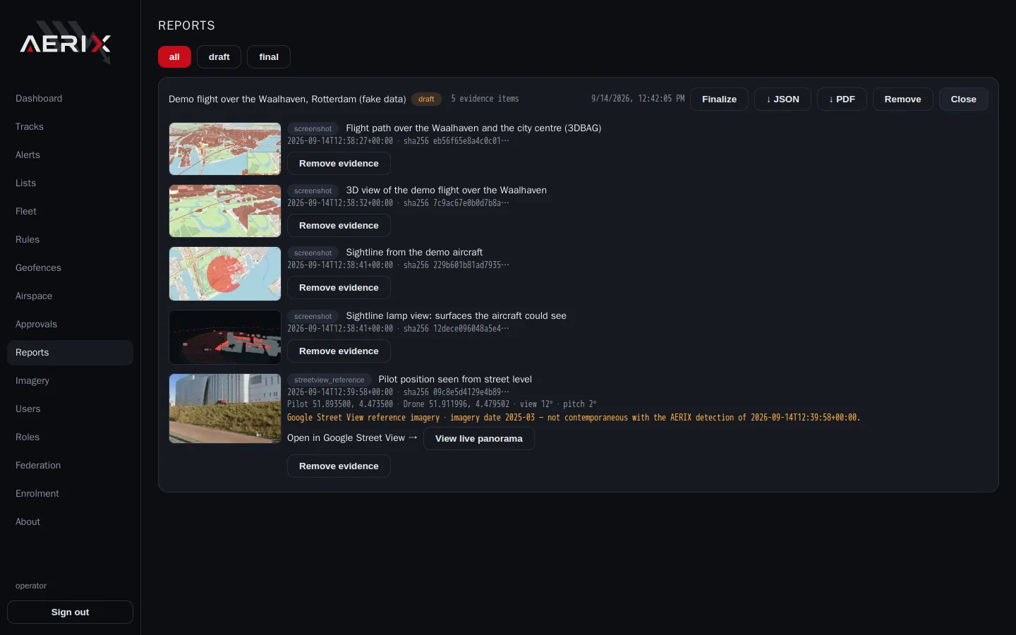
After an incident the questions come from outside: the regulator, the police, the site owner. AERIX keeps the track, the airspace it crossed, what it could have seen and the captures made along the way, and exports them as one structured report.

The same data is available through the API, so an alert can reach your own control room, video management or incident system without anyone retyping it.
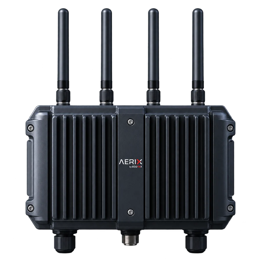
AERIX Pro detection unit with four antennas in a ruggedised housing
Detect, understand, respond

From a detection to a report, in the same tool.

A dot on a map is where most systems stop. AERIX carries on to context, review and structured reporting.

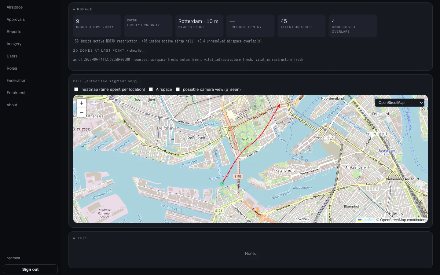
AERIX track view of a drone flight over Rotterdam with airspace context
Detect. Every track carries the zones it crossed, the nearest restriction and an attention score.
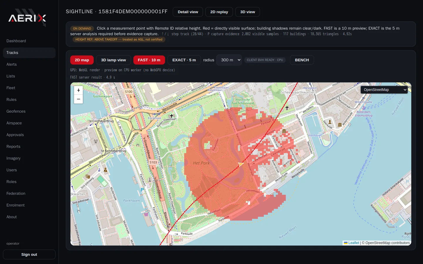
AERIX sightline analysis showing the area visible from the drone's position
Understand. What could the drone see? Terrain and buildings resolved to a visible surface, on demand.
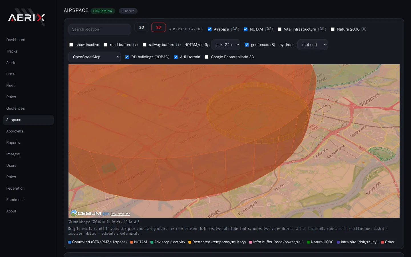
AERIX 3D scene with buildings and an airspace volume
Understand. Flights, buildings and airspace volumes in one 3D scene, from your own data and public terrain.
AERIX report view with captured evidence items for a flight
Respond. Captures, street-level references and a structured report, exported as JSON or PDF.
FAQ

Questions we get asked.

What is Remote ID, and is it enough?

Remote ID is the identification that drones are required to broadcast in flight. It tells you who and where, but only for drones that comply. That is why AERIX adds RF detection for the ones that stay silent, and takes in other sensors where they exist.

Do we need to install hardware to start?

No. With the AERIX app a phone works as a Remote ID sensor, so a first network can be running in minutes. Fixed nodes and RF sensors are added where permanent or wider coverage is needed.

Can AERIX work with the sensors and systems we already have?

Yes. Third-party sensor feeds such as ADS-B, AIS and cameras appear in the same picture, and alerts go to your own systems through the API.

Does AERIX stop a drone?

AERIX detects, tracks and documents. It gives the people who must respond the picture and the evidence to do so. The response itself stays with the responsible authority.

Where can I find out more?

The product website, aerix.ecotax.cloud, shows the platform, the hardware family and the deployments in more detail. For a demonstration, talk to us.

A safer sky for a more open world.

See the platform, the hardware and the deployments on the AERIX website, or contact us for a demonstration.

Visit aerix.ecotax.cloud